Overview (history, characteristics, attractions)
Kappa Bridge is a boardwalk-style suspension bridge in Kamikochi, Matsumoto City, Nagano Prefecture, and a popular tourist spot spanning the Azusa River. Located within Chubu-Sangaku National Park, Kamikochi boasts sweeping views of the clear waters of the Azusa River, forests of coniferous and broadleaf trees, and majestic mountain ranges, including the Hotaka mountain range and Mount Yakedake. Located at the center of the walking trail from Kamikochi Bus Terminal (or the direction of Taisho Pond), Kappa Bridge is a popular photo spot both in Japan and overseas. The bridge's name comes from the Japanese yokai (spirit monster) "kappa," and the surrounding area is home to a collection of souvenir shops, rest areas, and accommodations. The bridge has been rebuilt several times and is now a pedestrian suspension bridge made of wooden decking and metal wires.
Highlights
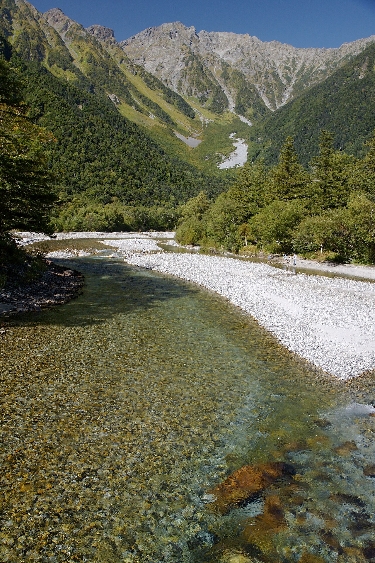
- View of the Hotaka mountain range, Mount Maehotaka, and Mount Okuhotaka: From Kappa Bridge, you can see the Hotaka mountain range directly in front of you, and if the weather is good, you can enjoy the spectacular view of the mountainside reflected on the river surface.
- The clear waters of the Azusa River and the scenery of the riverbank: The clear waters of the river, almost cobalt blue, continue, and the stones on the riverbank and the flowing water are beautiful.
- The different faces of the seasons: fresh greenery (May to June), summer greenery (summer), and autumn leaves (around October) are particularly spectacular. The snow scenery is often unavailable due to the winter closure of Kamikochi, but the mist around the mountain opening and in the early morning can create a fantastical atmosphere.
- Photo spot: The composition from near the center of the bridge is a classic. The morning and evening light and the smoke from Mt. Yakedake (which can sometimes be seen) are also impressive.
– Starting point and relay point for walking trails: A convenient base for hiking to Taisho Pond, Myojin Pond, and Mt. Myojin.
Access (nearest station, transportation, etc.)
– Nearest major station: Matsumoto Station (JR).
- Public transportation: During the peak season, there is a direct Alpico Kotsu express bus (Matsumoto - Kamikochi Line) from Matsumoto Station (takes approximately 1 hour 40 minutes to 2 hours). Alternatively, you can take the train from Matsumoto Station to Shinshimashima Station (Kamikochi Line), and then take a shuttle bus from Shinshimashima to Kamikochi (via Sawando and Hirayu, etc.). The Shinshimashima to Kamikochi bus takes approximately 40 to 50 minutes.
- Private cars: Generally, private cars are prohibited from entering Kamikochi (use local buses, shuttle buses, or taxis during the peak season). If you are traveling by car, park at the Sawando or Hirayu parking lot and then take a connecting bus to Kamikochi.
- Season and operation: Kamikochi is usually open from spring (late April to early May) to autumn (early November). In winter, the area is often closed or traffic is not available, so please check the latest information in advance.
– Kamikochi Bus Terminal (or walk to Kappa Bridge): From the bus terminal to Kappa Bridge, it takes about 15-30 minutes to walk along the footpath (depending on walking pace and traffic congestion).
Estimated stay (estimated time required)
- Short sightseeing tour at Kappa Bridge: 30 minutes to 1 hour if you just want to take photos and walk around the area.
– Main sightseeing in Kamikochi (light walks around Kappa Bridge, Taisho Pond, Myojin Pond, etc.): Half a day (3-4 hours).
- Trekking or visiting multiple spots: 1 day (all day) to multiple days (including overnight stays). If you are climbing Mt. Hotaka from Kamikochi, you will need several days.
Nearby spots
- Taisho Pond: A pond located along the road to Kappa Bridge. It was formed by the eruption of Mount Yakedake, and offers a beautiful view of the mountains and the lake.
– Myojin Pond and Mt. Myojin: A sacred pond and shrine located upstream of Kamikochi. Visitors can walk along the walking trail.
– Kamikochi Information National Park Center: Get nature information, exhibits, and the latest mountain climbing information.
– Mount Yakedake (view of the volcano) and Hotaka mountain range trailhead: A base for enjoying mountain climbing and the view.
– Matsumoto City: Matsumoto Castle, Nawate Street, Former Kaichi School, etc. (You can return to Matsumoto by car or bus for sightseeing.)
- Okuhida Onsen (Hirayu, Shinhotaka, etc.): Convenient for relaxing in hot springs after hiking or walking.
Things to be aware of (crowding, etiquette, seasonal precautions, etc.)
- Crowds: During Golden Week, summer vacation, and the autumn foliage season, the area is extremely crowded. Parking lots and buses may fill up, so we recommend leaving early in the morning and making reservations and checking schedules in advance.
- Manners: This is a national park area. Please be sure to take your trash with you and behave in a way that does not harm the environment. Collecting plants and feeding animals are prohibited. Please stay on the walking trails.
Weather and clothing: The altitude is around 1,500m, so it gets cold in the mornings and evenings. The weather can change suddenly (rain, fog, strong winds), so please bring warm clothing and rain gear. There are also slippery areas, so wear comfortable shoes.
- Traffic regulations: In most cases, private cars are prohibited from entering Kamikochi. Be sure to check traffic information and road conditions in advance.
- Business hours and facility information: Accommodation facilities, shops, and transportation services may change depending on the season. Please check the latest information, as there may be temporary closures or service suspensions especially in early spring and late autumn.
– Barrier-free access: The walking trails are well-maintained, but there are steps and unpaved roads in some places, so movement with wheelchairs or strollers may be limited. Please check the access methods in advance.
- Safety measures: It is dangerous to go into mountainous areas lightly dressed. If you are planning a hike or mountain climb, be sure to thoroughly check your equipment, maps, and weather information, and make a reasonable plan.
Supplement (recommended)
– Early morning and evening are the best times for photography as the lighting is good and it is relatively quiet.
– Kamikochi may tighten rules and manage visitor numbers from the perspective of nature conservation. Please check the latest information on the official website or Alpico Kotsu before visiting.
(You can copy this directly into the WordPress block editor.)