Overview (history, characteristics, attractions)
Mount Norikura is a mountain range with an elevation of approximately 3,026 meters located on the border between Matsumoto City, Nagano Prefecture, and Takayama City, Gifu Prefecture, and is known as part of the Hida Mountains (Northern Alps). It is made up of multiple peaks and a plateau (Norikura Plateau) formed by volcanic activity, and the area near the summit is characterized by an abundance of volcanic topography, fumaroles, wetlands, ponds, and alpine plants. The changing scenery throughout the seasons is an appealing sight, with alpine plants and cool plateau walks to be enjoyed in summer, autumn leaves to be seen in autumn, and lingering snow and snow corridors to be enjoyed in spring (just after the road opens).
Highlights
- Summit (highest peak): Approximately 3,026m above sea level. Enjoy the gentle ridgeline of Mt. Norikura and a 360-degree view. On a clear day, you may even be able to see the Northern Alps, Central Alps, and Mt. Fuji in the distance.
- Norikura Kogen: With hiking trails, pastures, marshes, and flower fields, this is the perfect place for a family stroll.
- Alpine plants and wetlands: In the summer, a wide variety of alpine plants bloom, and can be observed up close from the walking trails.
- Norikura Skyline (Norikura Echo Line, etc.): You can access the area by car or bus up to an altitude of around 2,700m, and its great appeal is that you can enjoy the high-altitude scenery in a short amount of time (however, there are seasonal operations and restrictions).
- Hot springs: There are hot springs scattered around the Norikura Plateau (such as Norikura Onsen), where you can relax and soothe your fatigue after hiking or exploring.
Access (nearest station, transportation, etc.)
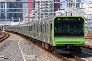
- The nearest major station is Matsumoto Station (JR), which is a convenient base for sightseeing.
- Bus: Seasonal buses operate from Matsumoto Station to Norikura Kogen and Tatamidaira (routes and times vary depending on the season). Route buses from Gifu (towards Takayama) also operate mainly in the summer. Please check the latest timetables and operating information of transportation operators in advance.
- By car: You can drive up to higher elevations on the Norikura Skyline or Echo Line, but please note that there are restrictions on private cars (to protect the environment and prevent congestion) and road closures in winter, so please check road information in advance.
- Starting point for the final climb or hike: It is common to walk from Tatamidaira (at about this altitude) or Norikura Plateau. It is convenient to take a local bus or shuttle to Tatamidaira.
Estimated stay (estimated time required)
- Plateau walk (Norikura Plateau): 1 to 3 hours (short walks to flower viewing).
- Round trip from Tatamidaira to the summit: Depending on the hiking route and your physical condition, it will take approximately 1-2 hours one way, and 2-4 hours round trip (not including the time it takes to get there).
- Day trip as a base for sightseeing: Depart from Matsumoto → Round trip by bus + one day of local exploration (leave early in the morning for plenty of time).
- Relaxed stay (including hot springs and sightseeing in the surrounding area): 1-2 nights recommended.
Nearby spots
- Norikura Kogen Onsen: Convenient for strolling and staying at a hot spring inn.
- Kamikochi and Kappabashi Bridge (a representative tourist spot in the prefecture): This can be combined depending on the season and route (Kamikochi is accessed by a different route from Matsumoto).
- Matsumoto Castle (Matsumoto City): A classic stop if you plan on combining sightseeing in the city.
- Shinhotaka Ropeway (Gifu side): A viewing spot of the Northern Alps. Combine it with Norikura to enjoy mountain sightseeing.
- Hot springs and tourist facilities around Awa Pass: Can be considered as a sightseeing route.
Things to be aware of (crowds, manners, seasonal precautions, etc.)
- Seasonal operations and road closures: Norikura Skyline and other routes are subject to winter closures and snow removal periods. The availability of buses and roads to Tatamidaira changes every year, so please check official information in advance.
- Restrictions on private cars and crowds: During the peak summer season and the autumn foliage season, the area can become congested and restrictions on private cars may be in place. Please consider using public transportation or leaving early in the morning.
- Risk of altitude sickness: Since you will be ascending to a high altitude in a short period of time, be aware of symptoms of altitude sickness such as headaches and dizziness. Stay hydrated, take care not to overexert yourself, and descend immediately if you feel unwell.
- Weather changes: The weather in the mountains can change suddenly, so be sure to bring warm clothing and rain gear to protect yourself from strong winds, fog, and rain.
- Environmental conservation and etiquette: Environmental conservation is important for alpine plants and marshes. Please be mindful of the vegetation, take your trash with you, and stick to designated routes.
- Bears and Wild Animals: There are wild animals in the area. Please be mindful of food and trash management at night and early in the morning.
- Toilets and food: Toilets and food facilities at high altitudes are limited, so be sure to bring along the necessary items (drinks, snacks, portable toilets, etc.).
- Drones and unauthorized photography: National parks and nature conservation areas may have restrictions on the use of drones and entry. Be sure to check the rules beforehand.
*Information may change depending on the season and year. Please be sure to check the latest information from the Nagano Prefecture/Matsumoto City Tourism Website, Norikura Tourism Association, transportation operators (bus companies), etc. before visiting.